7 January 2023

There was a time, say, after the fourth or fifth attempt to dig out the wheels and push it free, that we thought the bus was stuck for the night. The flat mud plain stretched miles in each direction, with just some pinpoints of lights against the darker mountains that showed where dwellings lay. We’d ended up there by trying to follow the rough road from Salinas de Garci Mendoza around the volcano Thunupa to Coqueza. Two roads diverged and we took the more direct route, not realizing that it cut across an arm of the salt flat that had been impregnated with dirt from the surrounding hills. It started off well—straight and flat—but rapidly diversified into multiple parallel tracks, each slightly worse than the next. At one point we rejoined the rough dirt road, but Jaime, our driver, was concerned that we were too far off the Google map track and so rather than follow the rough road inland he turned back to the flat land looking for the “right” track. That led quickly to the bus stopped in a rough area with its headlights lighting up a massively churned up low spot. I got out to check it out and found the ground soft everywhere. Already we were churning up mud, so the only thing to do was to back up and return to the rough road. That was easier thought than done and with the decision to quit backing and try to turn the bus around going forward on flat land we became hopelessly mired, the twin rear wheels spinning themselves into a gluey hole.

We were on our way from Oruro, the historic tin mining capital and home to the world-famous Carnaval parades, down to Coqueza and the Salar de Uyuni, the world’s largest salt flat. The sun had set on this drive after we left a quick visit to the dry lakebed of Lago Poopó and drove into a violent thunderstorm. At one point, as we waited at an intersection on the highway, a bolt of lightning struck the shoulder of the road just 75 yards ahead of the bus, a sizzling blast of light and instant boom. We could see smoke rising from the spot as we drove by! (The bus, by virtue of its rubber tires, was well insulated from lightning strikes.) By the time we’d left the paved road and were picking our way around the volcano, it was dark.
So we were stuck. As we looked at the damage, Camille summed up our attitude when she asked, full of business, “What do we need to do?” As some held lights, others looked for digging implements to dig out in front of the wheels and make a ramp for the bus to move up out of the holes it spun. Then we all got behind it and pushed like mad from the back. We gained one foot. Dig, clear, push. We gained another. Finally, after digging out the wheels for maybe the 8th time our pushing carried the bus on a wild mud chase back to the more solid track we’d left. You can bet there were screams of joy and high fives all around once we were there! Though we were coated in mud by then, we had a real accomplishment: we didn’t spend the night in a cold bus stuck on a mud flat. Arriving at the very comfortable Tambo Coqueza hotel on the edge of the Salar around 1:30am was especially glorious after working so hard to get there.
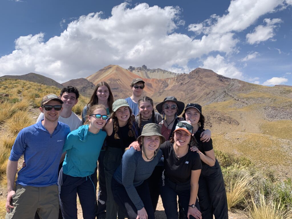
The next morning (8 January) we had planned to get up early to climb the volcano, but given our late arrival, that didn’t happen until around 11:00. Volcán Thunupa is a gas volcano that blew its top about 700 years ago, leaving an ochre and sand crater surrounded by jagged teeth. Pre-Incan Uru-Chipayan people lived in caves on its slopes (we learned from Aparicio at the Guide Association in town) and when it erupted the hot gas killed them in their homes. The dry caves and the arid environment here led to natural mummification of their remains, and some of those mummies had been gathered into one of the caves we visited on the way up. Our next goal was “Mirador 2” the viewpoint from which one can have panoramic views of the Salar and the top of the volcano. We hiked up between rock walls that defined llama pens and quinoa fields, slowly ascending up and up. We started the hike at around 13,000 feet and ended at 14,400 feet.
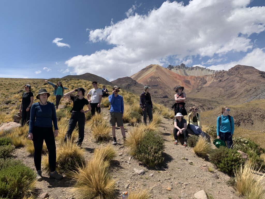
At that elevation most of us were taking slow baby steps and panting for oxygen in the thin air. Emily and Teddy took the lead, making it look effortless as they chatted and walked. The rest of us spread out in a file up the mountain and though some stopped more often than others, we all made it up. Like getting the bus out of the mud, arriving at the viewpoint was a real accomplishment!